IMPACT OF CYCLONE BIPARJOY ON MONSOON ARRIVAL
IMPACT OF CYCLONE BIPARJOY ON MONSOON ARRIVAL , RACE IAS : Best IAS Coaching in Lucknow , Daily Current Affairs
Main Examination: General Studies Paper 1
(Geography: Cyclone)
June 10, 2023
InNews:
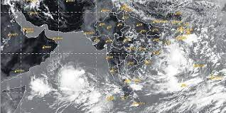
- According to IMD, Biparjoy, a severe cyclonic storm developing over the east-central Arabian Sea, may affect the arrival of monsoon.
- In the next few days, this storm can also affect Pakistan, Iran and countries adjacent to the Arabian Sea including India.
About Monsoon:
- Monsoon is a seasonal change in the direction of an area's prevailing, or strongest, winds. Monsoons cause wet and dry seasons in most of the tropics.
- Monsoon always moves from cold to warm regions. The summer monsoon and winter monsoon determine the climate for most of India and Southeast Asia.
Factors Affecting Monsoon:
Mascarine High:
- The Mascarene High influences India's weather patterns by creating a passageway and a safe passage for the arrival of monsoon winds over India.
- This high pressure area located between 25°S-35°S and 40°E-90°E near the Mascarene Islands in the southern Indian Ocean is a source of the southwest monsoon in India. Since it is a high pressure, it is also called muscarine high.
- Usually by mid-April a high pressure area starts forming and this is an important factor that determines the intensity of monsoon in India.
- If there is a delay in the formation of the Mascarene High, there is a possibility of delay in the onset of monsoon in India.
Coriolis force:
- The Coriolis force is a pseudo force, existing only because of the effect of the Earth's rotation. The rotational motion observed in tropical cyclones is also due to this force.
- Hence these monsoon winds get deflected towards east and now they blow from south-west to north-east direction. They split into two branches—the Arabian Sea branch and the Bay of Bengal branch.
Differential Heating:
- A mechanism is needed to attract monsoon winds from the Arabian Sea or the Bay of Bengal. Winds flow from areas of high pressure to areas of low pressure.
- The Himalayan range plays an important role in summer heating by blocking the intrusion of cold air from the north and allowing it to warm up.
- It is during this season that the land of India, especially Rajasthan and adjoining areas (Gujarat and Pakistan as well) heat up extensively.
- An increase in temperature has also been observed in the seas surrounding the country. As a result of the different heating rate and potential of the air over the sea and over the land, we see a gradient between the air pressure over the sea and over India (especially Rajasthan).
- The air pressure in India is less as compared to the southern part of the Arabian Sea and the Bay of Bengal. It acts as an attraction mechanism for the monsoon winds.
El Nino Southern Oscillation:
- The El Nino Southern Oscillation (ENSO) refers to the oscillating mode of sea surface temperature near the equatorial Pacific Ocean characterized by warming (El Nino) or cooling (La Nina) or neutrality.
- Due to its mostly unpredictable nature, ENSO has long been a major challenge for forecasters. Even reliable models have failed many times.
- ENSO has been a driver of global weather (especially in countries around the Pacific Ocean) because it affects atmospheric circulation.
Indian Ocean Dipole:
- In 1999, NH Saji of Japan's Aizu University and others discovered an ENSO-like phenomenon in the Indian Ocean which they named the Indian Ocean Dipole (IOD).
- Like the El Nino Southern Oscillation, the Indian Ocean Dipole (IOD) also has three phases – positive, negative and neutral.
- During the positive phase of the IOD, sea surface temperatures are warmer in the western Indian Ocean (which promotes the monsoon winds) than in the eastern Indian Ocean – hence a dipole nature.
- The opposite occurs during IOD negative and no gradient is observed during IOD neutral periods.
- It is observed that during the period of positive Indian Ocean Dipole, the Indian summer monsoon rainfall is much better than during the period of negative Indian Ocean Dipole. Despite 1994 and 2006 being El Niño years, India did not experience drought as the Indian Ocean Dipole (IOD) was quite positive.
About Cyclone:
- The word cyclone is derived from the Greek word cyclos which means the coil of a snake.
- The term was coined by Henry Paddington because tropical storms in the Bay of Bengal and the Arabian Sea look like coiled serpents of the sea.
- Cyclones are caused by atmospheric disturbances around a low pressure area, characterized by rapid and often destructive air circulation. The wind rotates in a counterclockwise direction in the Northern Hemisphere and clockwise in the Southern Hemisphere.
- Cyclones are classified as: (i) extra-tropical cyclones (also called temperate cyclones); and (ii) tropical cyclones.
- Different names are given to cyclones in different regions of the world:
- Cyclones in the China Sea and the Pacific Ocean are called typhoons;
- Hurricanes in the Caribbean Sea, the Atlantic Ocean and the West Indian Islands;
- Tornadoes in West Africa and Guinea Land in the southern United States;
- Willy-willies in northwestern Australia and tropical cyclones in the Indian Ocean.
What is the Impact of Cyclones on Monsoon:
- Some cyclones formed in the North Indian Ocean have both positive and negative effects on the onset of monsoon.
- The occurrence of cyclones delays the onset of the southwest monsoon, which usually starts in June and ends in September.
- A strong weather system in the Arabian Sea may disturb the progress of Monsoon inland. Under their influence, the monsoon current can reach the coastal parts but will struggle to penetrate beyond the Western Ghats.
- When the circulation of winds around cyclones is in a counterclockwise direction, the location of the cyclone is important as far as the effect of the cyclone on the transition to the monsoon trough is concerned (a monsoon trough is a low-pressure area characterized by a monsoon).
- For example, if a cyclone is located further north in the Bay of Bengal, westerly winds blowing from south-west to north-east can pull the monsoon trough further, and can help in the onset of monsoon.
- • Earlier this year, Cyclone Mocha developed in the Bay of Bengal in the first fortnight of May and briefly intensified into a 'Super Cyclonic Storm' before rapidly weakening at landfall.
- Mocha has ended and the westerly winds have helped the monsoon to reach Andaman and Nicobar Islands on time.
- Cyclone Biperjoy is not currently interacting much with the Monsoon Trough. However, its late birth as well as the late onset of the monsoon are both closely related to typhoons in the northwestern Pacific Ocean.
- The westerly winds, which pull the monsoon towards the Indian mainland, are now weak. All the moisture is circulating around the cyclone.
- Winds are blowing strongly to the northeast over the Bay, one of the major reasons why the Monsoon Trough is struggling to reach Kerala.
- Due to climate change, cyclonic storms in the Bay of Bengal and the Arabian Sea are rapidly intensifying and maintaining their intensity for longer periods.
Source: The Hindu
----------------------------------
Mains Exam Question
What do you understand by monsoon? Discuss the origin of Indian monsoon and the factors affecting it.